Philippine News
Hontiveros shows solidarity in Pag-asa Island visit
By Nash Villena, Philippine Canadian Inquirer
February 22, 2026
(Photo courtesy: Risa Hontiveros/Facebook)
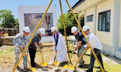
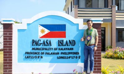
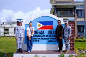
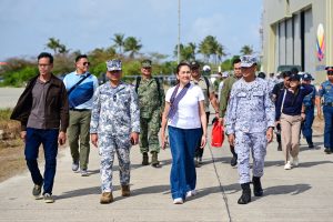
KALAYAAN, Palawan — Sen. Risa Hontiveros on Saturday visited the Pag-asa Island’s local community at the Kalayaan Island Group (KIG) in the West Philippine Sea (WPS) to show her continued solidarity with the locals amid territorial discussions.
“Sila at ang munisipalidad nila ay bahagi ng Pilipinas kaya hinding-hindi sila dapat pabayaan,” Hontiveros said in a post, affirming her stance not to give up the KIG.
(The locals and their municipality are part of the Philippines, thus we must never forsake them.)
“The Philippines is made up of thousands of beautiful islands, including Kalayaan. Napakaganda ng lugar na ito, tulad ng iba pang mga isla at likas-yaman sa ating bansa (This is such a beautiful place, just like our country’s other natural resources). We must protect and defend it with all that we’ve got,” she added.
(Photo courtesy: Risa Hontiveros/Facebook)
PCG WPS Spokesperson Commodore Jay Tarriela. who joined Hontriveros at the said visit, expressed his gratitude to the senator for her team’s services to the locals, including distributing groceries and organizing a medical mission with health practitioners.
“My heartfelt thanks also go to her for supplying groceries for the locals, organizing a medical mission complete with doctors and portable one-stop labs for comprehensive health check-ups, and generously providing over 20 portable desalinator machines to support our troops in different maritime features in KIG,” Tarriela wrote in a post.
The municipality of Kalayaan, commonly referred to as the largest municipality in the country due to its large bodies of water, is under the jurisdiction of Palawan province and has been a central subject among public officials, with some even implying the surrender of the area because they claim it sits outside the country’s Exclusive Economic Zone (EEZ).
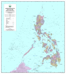
(Photo courtesy: National Mapping and Resource Information Authority)
The National Mapping and Resource Information Authority (NAMRIA), however, has previously spoken up about the issue and reminded the public that the KIG, as well as the WPS at large, have always been included in the country’s maps and charts for more than a decade.
“Since 2012, the Philippines has formally used the name West Philippine Sea in government publications,” NAMRIA said in a statement.
NAMRIA explained that under international law, the EEZ extends up to 200 nautical miles from the country’s archipelagic baselines, creating a continuous curved boundary rather than a polygon with straight lines.
Ergo, enlisting a short list of coordinates would be inaccurate in defining the country’s maritime limit.
The mapping agency said its nautical charts also adhere to international hydrographic standards and are submitted to relevant global technical bodies, including those of the International Hydrographic Organization.