Headline
New tropical cyclone to enter PAR Tuesday
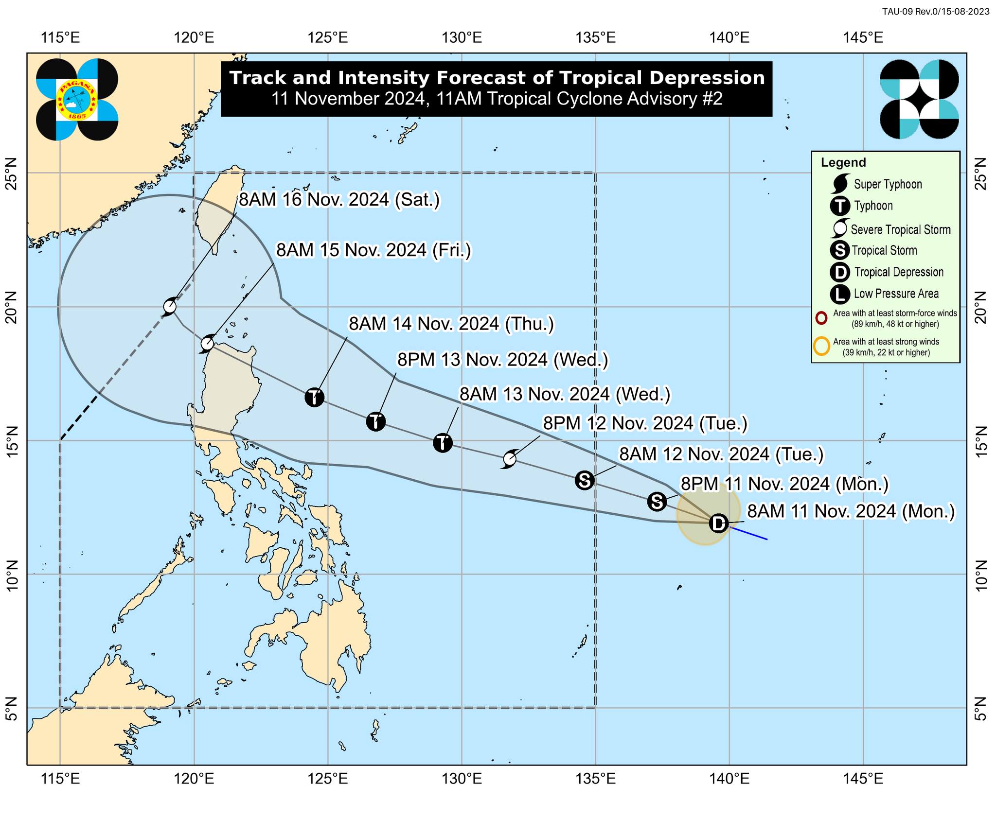
NEW TROPICAL CYCLONE. Track of a tropical cyclone that is likely to enter the Philippine Area of Responsibility on Tuesday (Nov. 12, 2024). Once inside PAR, it will be named Ofel. (Photo: dost_pagasa/Facebook)
MANILA – Another tropical cyclone is forecast to enter the Philippine Area of Responsibility (PAR) on Tuesday and is seen to impact Northern Luzon.
As of 10 a.m. Monday, the tropical depression outside PAR was located at 1,480 km. east of Eastern Visayas, according to the Philippine Atmospheric, Geophysical and Astronomical Services Administration (PAGASA).
“It is heading towards PAR and is likely to make landfall over Northern Luzon,” PAGASA forecaster Chris Perez said in a briefing before noon.
Once inside PAR, the tropical cyclone will have the local name Ofel.
As of 11 a.m. Monday, the cyclone packs maximum sustained winds of 55 kph near the center and gustiness of up to 70 kph.
PAGASA forecast the cyclone to intensify and reach the typhoon category on Wednesday.
The bureau added that while it is too early to determine the specific areas to be affected by certain hazards, areas in Northern Luzon are at risk of heavy rainfall, severe wind, and, possibly, storm surge inundation.
The eastern portions of Central and Southern Luzon may also be affected, PAGASA said.
Moreover, the cyclone may bring potentially risky sea conditions over the northern and eastern seaboard of the Bicol Region and the eastern seaboard of Eastern Visayas beginning mid-Wednesday.
Meanwhile, Perez said another tropical cyclone with international name Man-yi is being monitored.
“It is still too far and was last located 3,280 km. east of southeastern Luzon, outside PAR,” he said.
Perez advised the public to keep monitoring PAGASA for updates.