Breaking
LPA expected too dissipate within the next 24 hours –PAGASA
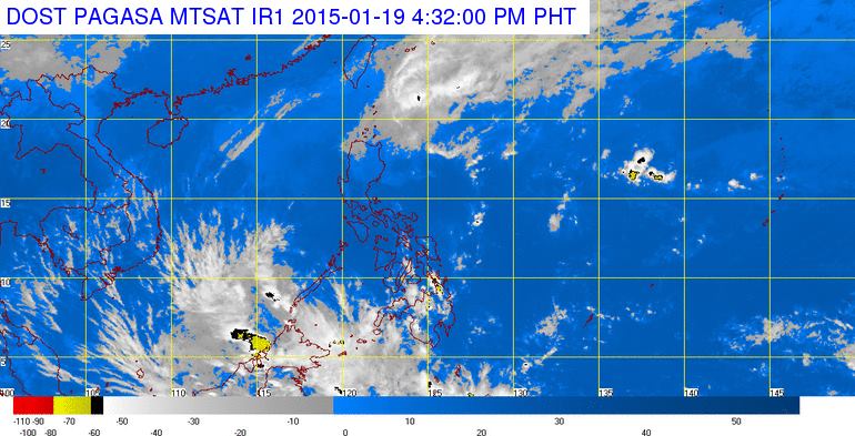
MANILA — The low pressure area (or the former tropical storm “Amang”) off Cagayan is expected to dissipate within the next 24 hours, according to the Philippine Atmospheric, Geophysical and Astronomical Services Administration (PAGASA) on Monday.
In an interview, PAGASA weather forecaster Shelley Ignacio said that with the presence of strong cold winds from the northeast monsoon, the LPA has slim chance to reintensify into a tropical cyclone and is expected to dissipate in the next 24 hours.
Ignacio said that as of 4 p.m., the LPA was estimated based on all available data at 160 kilometers east- southeast of Tuguegarao City, Cagayan (17.
3˚N, 123.2˚E).
The combined effects of the northeast monsoon and the LPA will bring cloudy skies with light to moderate rains over the regions of Cagayan Valley, Cordillera and Ilocos.
In the next 24-hour forecast, PAGASA said the rest of Luzon, including Metro Manila, will have partly cloudy to at times cloudy skies with isolated light rains while the Visayas and Mindanao will be partly cloudy to cloudy with isolated rains.
Thunderstorms are likely to occur over these areas.
Moderate to strong winds blowing from the northeast to north will prevail over Luzon and coming from east to northeast over the Visayas and Mindanao with moderate to rough seas.
The state weather bureau also issued gale warning due to the effects of the northeast monsoon which will bring rough to very rough sea conditions over the seaboards of Northern Luzon and the western seaboard of Central Luzon.
“Fisherfolks and those using small seacrafts are advised not to venture out over the said seaboards,” it warned.