Breaking
Probability for ‘Nangka’s PAR entry shrinks further
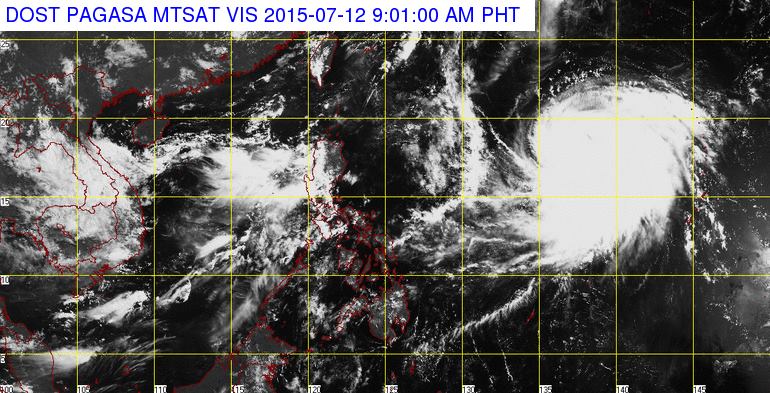
MANILA — Weather forecasters see a more dwindling chance for the tropical cyclone, with international name ‘Nangka’, to enter the Philippine Area of Responsibility (PAR), landfall and directly affect the country.
“There’s even smaller chance for such occurrence,” said forecaster Shaira Nonot from State weather agency Philippine Atmospheric, Geophysical and Astronomical Services Administration (PAGASA).
She noted the latest forecast was for ‘Nangka’ to move northwards in forthcoming days and head towards southern Japan, instead of crossing the Pacific then entering PAR and make a landfall in the country like other previous tropical cyclones did.
If such forecast movement proves accurate, it’ll spare the Philippines from the direct fury of ‘Nangka.’
PAGASA forecaster Jori Loiz said data as of 5 p.m. Saturday (July 11) show ‘Nangka’ as packing maximum sustained winds of 150 kilometers per hour near its center and gustiness of up to 185 kilometers per hour.
“That wind intensity ranks ‘Nangka’ as a typhoon already,” he said, citing PAGASA’s updated tropical cyclone classification.
He noted because of such intensity, government can be expected to raise public storm warning signal (PSWS) 3 in areas directly hit by the typhoon’s eye wall.
Eye wall is the region just outside a typhoon’s eye or center.
Experts warned eye wall is where a typhoon’s most damaging winds and intense rainfall are.
PAGASA expects “moderate to heavy” damage in areas under PSWS 3.
Waves over 14 meters high in seas off those areas and storm surges along the coast there are also possible, PAGASA added.


