Headline
Two possible storms may enter PAR next week, says PAGASA
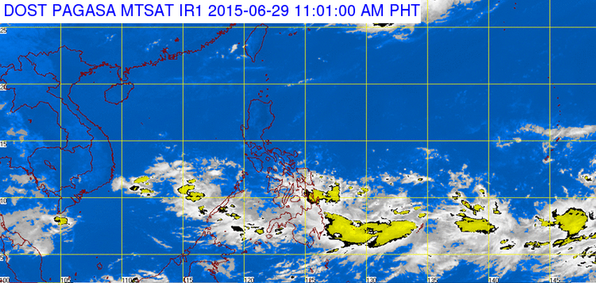
MANILA – With the onset of the rainy season, the Philippine Atmospheric, Geophysical and Astronomical Services Administration (PAGASA) projected two possible tropical cyclones to enter the Philippine area of responsibility (PAR) next week.
The first low pressure area (LPA) was seen some 1,500 to 2,000 kilometers east of Mindanao over the Pacific Ocean, said PAGASA weather forecaster Gladys Saludes in a Philippine Daily Inquirer report.
The other LPA was seen some 500 kilometers east of the Philippines.
Both LPA’s may develop into tropical depressions or storms, Saludes said in the same report.
The public may expect cloudy skies with moderate to heavy rains and thunderstorms which may cause flashfloods and landslides on Monday.
In Luzon, partly cloudy to cloudy skies with occasional rains are projected. In Visayas, light to moderate rains may fall.
PAGASA also disclosed that light to moderate winds coming from the southwest will prevail in the rest of the country.
The weather bureau earlier said that it expected 11 to 16 typhoons to hit the archipelago in 2015.


