Environment & Nature
El Niño is coming, and ocean temps are already at record highs – that can spell disaster for fish and corals

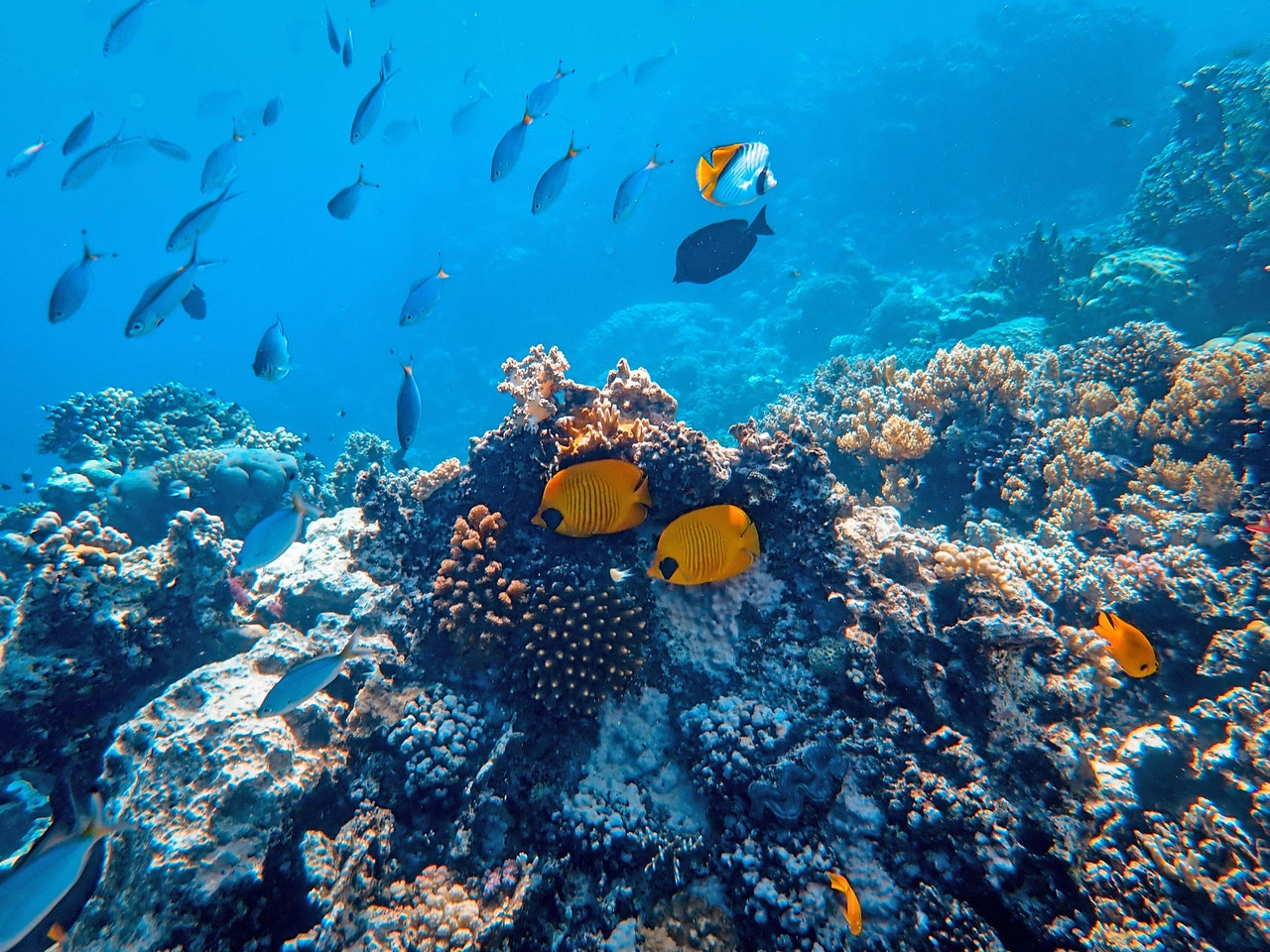
Marine heat waves can reach the ocean floor as well as surface waters. (Pexels Photo)

Sebastian Pena Lambarri via Unsplash, CC BY
It’s coming. Winds are weakening along the equatorial Pacific Ocean. Heat is building beneath the ocean surface. By July, most forecast models agree that the climate system’s biggest player – El Niño – will return for the first time in nearly four years.
El Niño is one side of the climatic coin called the El Niño-Southern Oscillation, or ENSO. It’s the heads to La Niña’s tails.
During El Niño, a swath of ocean stretching 6,000 miles (about 10,000 kilometers) westward off the coast of Ecuador warms for months on end, typically by 2 to 4 degrees Fahrenheit (about 1 to 2 degrees Celsius). A few degrees may not seem like much, but in that part of the world, it’s more than enough to completely reorganize wind, rainfall and temperature patterns all over the planet.
I’m a climate scientist who studies the oceans. After three years of La Niña, it’s time to start preparing for what El Niño may have in store.
How El Niño affects the planet
No two El Niño events are exactly alike, though we’ve seen enough of them that forecasters have a pretty good idea of what’s likely to happen.
People tend to focus on El Niño’s impact on land, justifiably. The warm water affects air currents that leave areas wetter or drier than usual. It can ramp up storms in some areas, like the southern U.S., while tending to tamp down Atlantic hurricane activity.
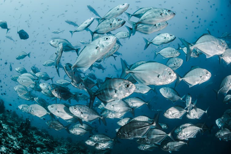
El Niño can also wreak havoc on the many marine ecosystems that support the world’s fishing industries, including coral reefs and seagrass meadows.
Specifically, El Niño tends to trigger intense and widespread periods of extreme ocean warming known as marine heat waves.
Global ocean temperatures are already at record highs, so El Niño-induced marine heat waves could push many sensitive fisheries to a breaking point.
The problem with marine heat waves
A marine heat wave is just that: a “wave” of extreme heat in the ocean, not dissimilar to an atmospheric heat wave on land.
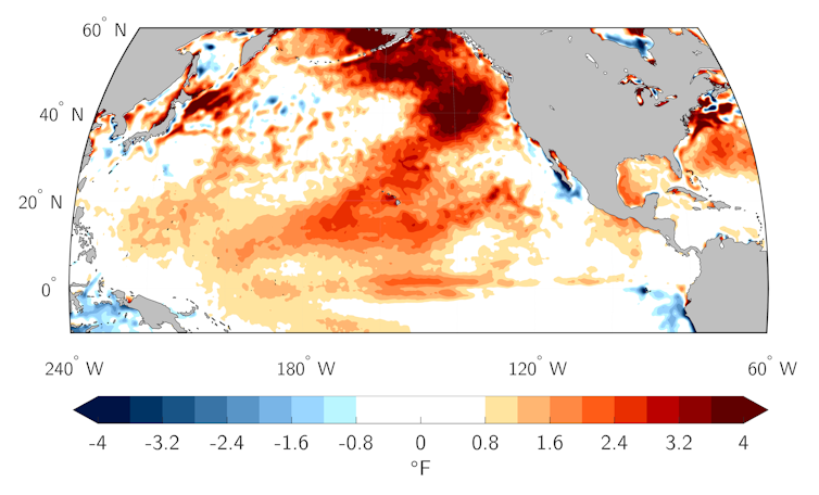
At their smallest, marine heat waves can inundate local bays and coves with hotter-than-normal water for a few days or weeks. At their largest, marine heat waves like the Northeast Pacific Warm Blob of 2013-2014 can grow to gargantuan proportions, with regions three times the size of Texas experiencing ocean temperatures 4 to 6 F (about 2 to 3 C) above average for months or even years.

Dillon Amaya
Warm water might not seem like a big deal, especially to surfers hoping to leave their wetsuits at home. But for many marine organisms that are highly adapted to specific water temperatures, marine heat waves can make living in the ocean feel like running a marathon.
For example, some fish increase their metabolism in warm waters by so much that they burn energy faster than they can eat, and they can die. Pacific cod declined by 70% in the Gulf of Alaska in response to a marine heat wave. Other impacts include bleached corals, widespread harmful algal blooms, decimated seaweeds and increased marine mammal strandings. All told, billions of U.S. dollars are lost to marine heat waves each year.
Marine heat waves flare up for a variety of reasons. Sometimes ocean currents shift warm water around. Sometimes surface winds are weaker than normal, leading to less evaporation over the ocean and warmer waters. Sometimes cloudy places just aren’t as cloudy for a few months, which lets more sunlight in and heats up the ocean. Sometimes both weaker winds and fewer clouds happen at the same time, producing record-breaking marine heat waves.
Where El Niño fits in
In the climate system, El Niño is king. When it dons its fiery crown, the entire planet takes notice, and the oceans are no exception. But the likelihood of increased marine heat wave activity during El Niño depends on where you are.
Along the U.S. West Coast during El Niño, surface winds that normally blow from the north tend to subside. This weakens evaporation and slows upwelling of colder, deeper water. That increases the chances of coastal marine heat waves.
Peruvian fishers have for centuries weathered periods of extreme ocean warming that drive fish away. It wasn’t until the 1920s that scientists realized that these South American marine heat waves were related to the Pacificwide ENSO.
In the Bay of Bengal east of India, interactions between El Niño and a tropical air flow pattern known as the Walker Circulation elevate the risk for marine heat waves.
Seafloor heat waves are another risk
Even if marine heat waves aren’t more obvious at the ocean surface this year, it doesn’t mean all is well down below.
In a recent study, my colleagues and I showed that marine heat waves also unfold along the seafloor of coastal regions. In fact, these “bottom marine heat waves” are sometimes more intense than their surface counterparts. They can also persist much longer. For example, a 1997-1998 bottom marine heat wave off the U.S. West Coast lasted an extra four to five months after surface ocean temperatures had already cooled.
Events like this can be related to El Niño and put a lot of stress on bottom-dwelling species. Bering Sea snow crab landings were down 84% in 2018 after a marine heat wave reached the seafloor.
We’re in (for) hot water
With El Niño on the horizon, what can we expect for this year?
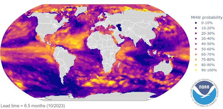
The good news is seasonal forecast models can skillfully predict marine heat waves three to six months in advance, depending on the region. And forecasts tend to be most accurate during El Niño years.

NOAA/Jacox, et al. 2022
The latest forecast predicts several active marine heat waves to persist into June-August, including in the North Pacific, off the coast of Peru, southeast of New Zealand and in the tropical North Atlantic.
The same forecasts predict El Niño to ramp up over the next six to nine months, increasing marine heat wave risk in January to March of 2024 for the U.S. West Coast, the western Indian Ocean, the Bay of Bengal, and the tropical North Atlantic.
That said, these predictions are far enough out that things could change. Time will tell whether they hold (hot) water, but we would do well to prepare. El Niño is coming.![]()
Dillon Amaya, Climate Research Scientist, National Oceanic and Atmospheric Administration
This article is republished from The Conversation under a Creative Commons license. Read the original article.


