Headline
‘Butchoy’ moves slower to Taiwan at 25 kph

Photo: DOST Pagasa/Facebook
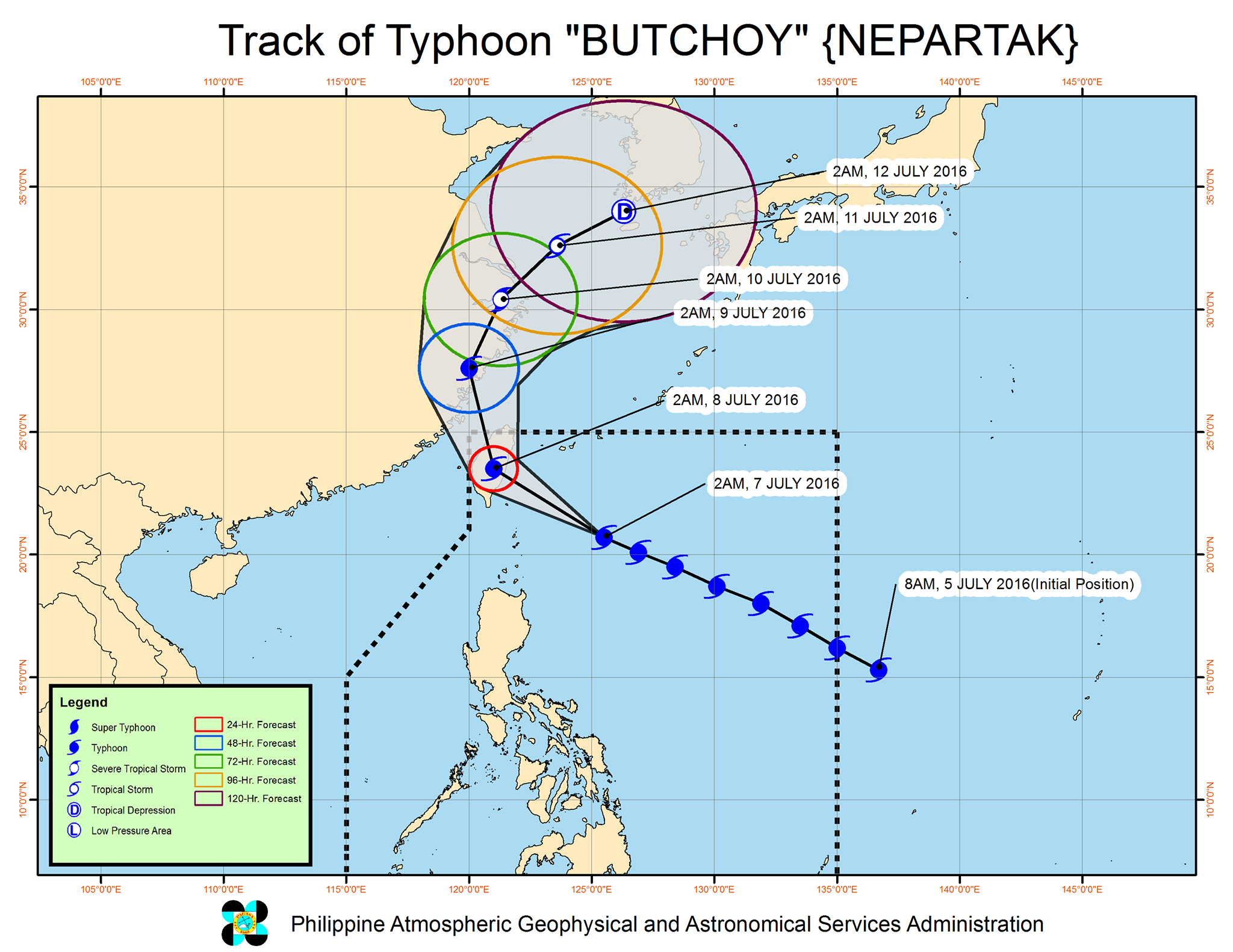
MANILA—Typhoon “Butchoy” (international name: Nepartak) is expected to exit the Philippine Area of Responsibility on Friday, as it continues to move northwest to Taiwan at a slower pace of 25 kph, the state weather bureau said.
Philippine Atmospheric, Geophysical and Astronomical Services Administration (PAGASA) said the typhoon was last eyed at 330 km east of Basco, Batanes which was placed under Signal No. 1. Aside from Batanes, nearby Calayan and Babuyan group of islands will experience rains with gusty winds.
“Butchoy” packs maximum sustained winds of 220 kph near the center, with gustiness of up to 255 kph.
It continues to enhance the southwest monsoon affecting southern Luzon and Visayas.
Metro Manila, the rest of Cagayan Valley, Cordillera Administrative Region, Ilocos, Central Luzon, Calabarzon, Mimaropa, Bicol, Visayas, Caraga, Zamboanga Peninsula and northern Mindanao may expect cloudy skies with light to moderate rains and thunderstorms.
Partly cloudy to cloudy skies with isolated rainshowers or thunderstorms will prevail over the rest of the archipelago.
PAGASA said moderate to strong winds will blow from the southwest over Visayas, Mindanao and the rest of Luzon.
Coastal waters along these areas will be moderate to rough, it added.


