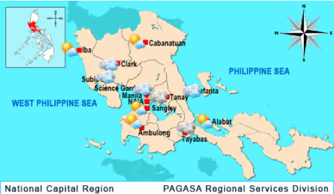
MANILA – The country will unlikely experience inclement weather from severe tropical storm ‘Igme’ (international name ‘Chaba’) which entered the Philippine Area of Responsibility (PAR) Saturday morning.
‘Igme’ is too far to enhance the rain-driving southwest monsoon or ‘habagat’ and is not even expected to make landfall, noted weather forecaster Rene Paciente from the state-run Philippine Atmospheric, Geophysical and Astronomical Services Administration (PAGASA).
“If ‘Igme’ doesn’t enhance ‘habagat,’ the country will likely experience good weather this Sunday and Monday,” he said.
A cyclonic circulation over the West Philippine Sea at present and the weakening of the low-pressure area (LPA) north of Luzon are further lessening the chance for inclement weather, Paciente continued.
“The cyclonic circulation may pull ‘habagat’ westwards away from the country,” he said.
He also noted that the LPA’s enhancement of the ‘habagat’ continues to ease.
“That LPA may already dissipate within the next 24 hours,” he said, referring to the period ending Sunday morning.
PAGASA located the LPA at some 270 km. west of Batanes province’s capital Basco as of 4 a.m. Saturday.
Despite the optimistic weather outlook, Paciente cautioned about the continuing occurrence of thunderstorms in the country.
“Thunderstorms are still possible, particularly during afternoons and evenings so people must prepare for these accordingly,” he clarified.
According to PAGASA weatherman Alex Cada, ‘Igme’ entered PAR at about 10 a.m. Saturday while packing maximum sustained winds of up to 100 kph and gustiness of up to 125 kph.
‘Igme’ moved northwestwards at 25 kph, he noted.
PAGASA located ‘Igme’ at some 1,380 km. east of Aurora province’s Casiguran municipality as of 10 a.m. Saturday, he also said.
There’s no chance for ‘Igme’ and the LPA to interact, said Paciente.
“Those weather systems are too far from each other – about 1,800 km. apart,” he said.
He said ‘Igme’ may exit PAR on Monday.
PAGASA also forecast ‘Igme’ to be 1,270 km. northeast of Basco by Tuesday morning, well outside PAR.
Paciente noted ‘Igme’ is still over water where it can draw energy needed to increase strength.
If ‘Igme’ intensifies, he said this storm can enhance the ‘habagat.’
Aside from light to moderate winds, he said such enhancement will likely bring light to moderate rains only over the western seaboards of Luzon and the Visayas.
“We’re not expecting strong rains since ‘habagat’ is already easing and about to end as transition to the northeast monsoon or ‘amihan’ nears,” he said.
He sees a low chance for enhancement of the ‘habagat’ and inclement weather, however.
Indicators instead favor the likely occurrence of good weather this Sunday and Monday, he added.