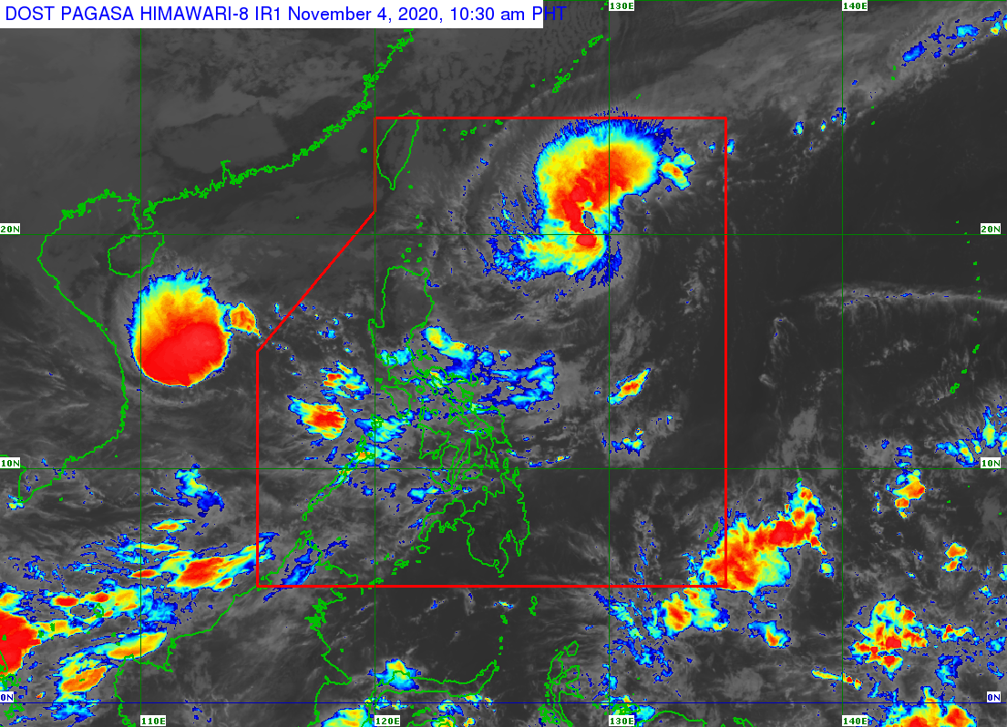
MANILA – Tropical Storm (TS) “Siony” maintained its strength, and strong winds continue to prevail over parts of northern Luzon, the weather bureau said on Wednesday.
In an update posted before noon, the Philippine Atmospheric, Geophysical and Astronomical Services Administration (PAGASA) said “Siony” packs a maximum sustained winds of 85 kph near the center and gustiness of up to 105 kph. It was last seen 755 km. east of Basco, Batanes.
Strong breeze to gale force winds with higher gusts continue to prevail over Batanes, Babuyan Islands, and the northern coastal areas of Cagayan and Ilocos Norte, PAGASA added.
As of 1:30 p.m., PAGASA said moderate to heavy rain showers with lightning and strong winds are expected over Nueva Ecija, Zambales, Rizal, Cavite within the next two hours.
“The above conditions are being experienced in Batangas (Nasugbu, Taal, Santa Teresita, San Luis), Quezon (Mauban), Laguna (Paete, Kalayaan, Lumban, Bay, Calauan), which may persist within two hours, and may affect nearby areas,” it said in the advisory.
Tropical cyclone wind signal no. 1 is still hoisted over the northeastern portion of mainland Cagayan (Santa Ana, Gonzaga), and the eastern portion of Babuyan Islands (Balintang Island, Babuyan Island, Didicas Island, and Camiguin Island, including their adjoining islets).
The northeasterlies and the trough of “Siony” will cause light to moderate with at times heavy rains over the Bicol Region, northern Samar, Aurora, Quezon, and the eastern portion of Cagayan and Isabela.
PAGASA maintained that flooding and rain-induced landslides may occur during heavy or prolonged rainfall, especially in areas highly susceptible to these hazards, and/or those that received significant rainfall from Tropical Cyclones “Pepito”, “Quinta” and “Rolly”.
“Rolly” exited the Philippine Area of Responsibility (PAR) on Tuesday night.
However, “Rolly”, “Siony”, and the northeasterlies will cause rough to very rough seas over the entire seaboards of northern Luzon, the northern seaboard of Camarines Sur, the northern and eastern seaboards of Catanduanes, and the seaboards of Aurora, Camarines Norte, Kalayaan Island, and northern Quezon, including the northern and eastern coastal waters of Polillo Island. Sea travel is risky over these areas.
Moderate to rough seas continue to prevail over the western seaboard of Central Luzon, the eastern and western seaboards of Southern Luzon, and the eastern seaboards of Visayas and Mindanao.
PAGASA said mariners of small seacraft are advised to take precautionary measures when venturing out to sea.