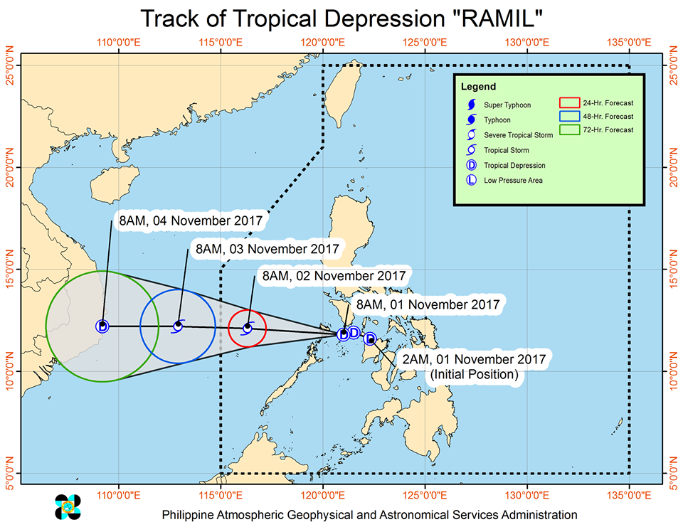
MANILA— Tropical depression ‘Ramil’ has strengthened and is now in the vicinity of Calamian Group of Islands.
The Philippine Atmospheric Geophysical and Astronomical Services Administration (PAGASA) said ‘Ramil’ was last spotted at 25 km east of Coron, Palawan, packing maximum sustained winds of up to 55 kph near the center and gustiness of up to 75 kph.
‘Ramil’ is moving west at 18 kph and is expected to leave the Philippine Area of Responsibility (PAR) on Friday.
Tropical Cyclone Warning Signal (TCWS) No. 1 is raised over Northern Palawan including the Calamian Group of Islands and southern Occidental Mindoro.
Areas within the 200-km diameter of the tropical depression will experience moderate to occasionally heavy rains.
PAGASA advised residents in areas under TCWS No. 1 as well as Central Luzon, Cagayan Valley Region and the northern portion of Quezon including Polillo Island against possible landslides and flashfloods.
Sea travel remains risky over the areas under TCWS #1, including the northern and eastern seaboard of Luzon due to the tropical depression and the surge of the northeast monsoon.