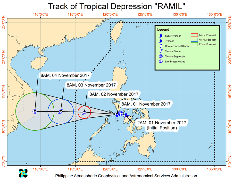
MANILA — Tropical depression ‘Ramil’ maintained its strength as it moves towards the Calamian Group of Islands, bringing rains to most parts of the country on All Saints’ Day.
State weather bureau Philippine Atmospheric Geophysical and Astronomical Services Administration (PAGASA) said ‘Ramil’ was last spotted at 100 km east of Coron, Palawan, packing maximum sustained winds of up to 45 kph near the center and gustiness of up to 60 kph.
‘Ramil’ is moving west at 20 kph and is expected to leave the country on Sunday.
Tropical Cyclone Warning Signal (TCWS) No. 1 is raised over Northern Palawan including Calamian Group of Islands, Southern Occidental Mindoro, and Southern Oriental Mindoro.
Areas within the 200 km diameter of the tropical depression will experience moderate to occasionally heavy rains.
Metro Manila, Bicol Region, Calabarzon and the provinces of Marinduque, Mindoro, Romblon and the rest of Palawan will have cloudy skies with scattered rains and thunderstorms.
The rest of Luzon will have cloudy skies and light rains due to the northeast monsoon.
The rest of Mindanao will experience partly cloudy to cloudy with isolated rainshowers and thunderstorms due to localized thunderstrorms.
Sea travel is risky over the seaboard of Northern Luzon and the eastern seaboard of Central and Southern Luzon.