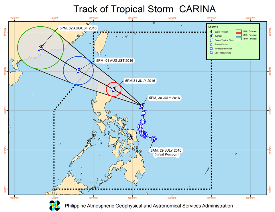
MANILA – State weather agency Philippine Atmospheric, Geophysical and Astronomical Services Administration (PAGASA) said “Carina” has intensified into a tropical storm as it continues to move towards northern Luzon.
“Carina” has a maximum sustained winds of 65 kph near the center, and gustiness of up to 80 kph. It is forecast to move north northwest at 18 kph.
Moderate to heavy rains within the 400 km diameter of the tropical storm may be expected.
Fisherfolk are warned against rough to very rough seas over the eastern seaboards of Camarines Norte and Quezon including Polillo Island.
Tropical Cyclone Warning Signal (TCWS) No. 2 was raised over Isabela, while Cagayan including Babuyan Group of Islands, Apayao, Ilocos Norte, Aurora, Catanduanes, Camarines Sur, Albay, Sorsogon and northern Samar were put under TCWS No. 1.
Areas under TCWS No. 1 and 2, as well as the rest of Cagayan Valley, rest of Cordillera and the provinces of Masbate, Camarines Norte and Quezon are alerted against moderate to heavy rains which may trigger flash floods and landslides.
The center of “Carina” was last spotted at 290 km. northeast of Virac, Catanduanes.
Meanwhile, at 4:45 p.m. Saturday, PAGASA said thunderstorm is affecting Metro Manila (Valenzuela, Navotas, Malabon), Nueva Ecija(Gen. Tinio, Rizal, Gabaldon), Zambales (San Marcelino, Castellejos), Quezon(Tiaong), Batangas(San Juan) and portions of Bulacan. This may persist for one to two hours.
The state weather agency added that Pampanga, Rizal and other areas of Metro Manila, Bulacan, Nueva Ecija, Zambales, Batangas and Quezon may expect thunderstrom within the next 2 hours.
The intermittent light to moderate with occasional heavy rains currently affecting portions of Quezon may persist for several hours, PAGASA said.