MANILA – Typhoon “Hanna” has maintained its strength while continuing to head toward the Batanes-Taiwan area, the Philippine Atmospheric Geophysical and Astronomical Services Administration (PAGASA) said on Friday.
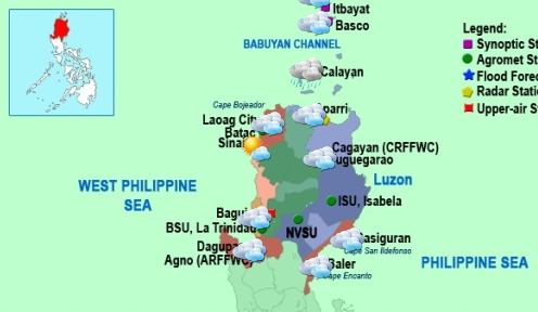
In its latest severe weather bulletin, PAGASA said the eye of typhoon “Hanna” was located at 335 kilometers (km) northeast of Itbayat, Batanes (22.6°N, 124.4°E) as of 4 p.m. on Friday.
The state-run weather bureau added that it expects “Hanna” to move west-northwest at 20 kilometers per hour (kph), while having maximum sustained winds of 165 kph near the center and gustiness of up to 200 kph.
The estimated rainfall within the 750-km diameter of the typhoon will be moderate to heavy.
PAGASA has raised Public Storm Warning Signal No. 2 in Batanes province, including Itbayat, which will experience 61-120 kph winds expected in 24 hours. It also warns the public against 4.1- to 14-meter storm surges along the coastal areas.
The weather agency said among the possible impacts of PSWS 2 are: light to moderate damage to high-risk structures; very light to light damage to medium-risk structures; no damage to very light damage to low-risk structures; structures of light materials are partially damaged or unroofed; nipa and cogon houses may be partially or totally unroofed; old galvanized iron (G.I.) roofs may be peeled or blown off; and wooden or old electric posts are tilted or downed.
PAGASA also issued PSWS No. 1 in the Calayan and Babuyan Group of Islands and Northern Cagayan which will experience 30-60 kph winds expected in 36 hours. These areas will experience storm surges of 1.25-4.0 meters.
PAGASA said it expects typhoon “Hanna” to be outside the Philippine Area of Responsibility (PAR) or 450 km north- northwest of Itbayat, Batanes by Saturday afternoon.
By Sunday afternoon, PAGASA forecasts the weather disturbance will be 850 km northwest of Itbayat, Batanes.
PAGASA also advises fisherfolks not to head out to sea in the seaboards of Luzon, the Visayas and Eastern Mindanao.
Meanwhile, the weather bureau said the southwest monsoon is bringing rains to Calabarzon (Cavite, Laguna, Batangas, Rizal and Quezon); Mimaropa (Mindoro Occidental/Oriental, Marinduque, Romblon and Palawan); Bicol Region and the Visayas, adding residents in low-lying and mountainous areas are alerted against possible flashfloods and landslides.