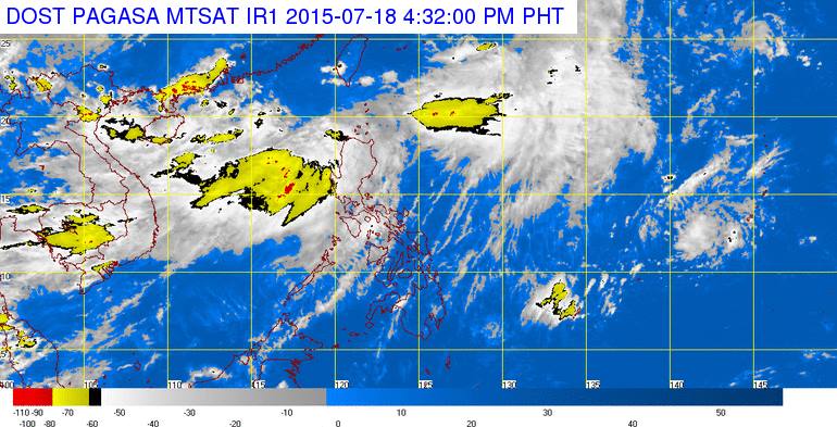
MANILA — The Philippine Atmospheric Geophysical and Astronomical Services Administration (PAGASA) expects the Low Pressure Area (LPA) not to strengthen further as it heads Northward.
In an interview, PAGASA Weather Forecaster Fernando Cada said “based on our monitoring the LPA is weak right now due to its high position in the North.”
He added the LPA would bring rains to West Luzon, enhanced by “hanging habagat”.
Cloud clusters were also forming near West Luzon, which would also dump rains to North and Central Luzon.
PAGASA also warned the public against “hanging habagat’s” rains that might cause flashfloods and landslides in Luzon.
In its 5 p.m. Weather Bulletin Saturday, a 24-hour forecast, PAGASA said “monsoon rains which may trigger flashfloods and landslides will be experienced over Ilocos and Cordillera, the Provinces of Zambales, Bataan, including the islands of Batanes, Calayan and Babuyan.”
“Hanging habagat”, which is also known as the southwest monsoon, dumps rains to the country from April to October.
PAGASA further warned occasional rains will occur for the rest of Central Luzon, Cagayan Valley and the province of Mindoro.
Other parts of the country will have partly cloudy to cloudy skies with isolated thunderstorms.
Luzon and Visayas will also experience moderate to strong winds coming from the Southwest, causing seas to be moderate to rough.
Other areas will also experience light to moderate winds, blowing from the southwest, affecting seas to be slight to moderate.
Meanwhile, PAGASA has issued a gale warning over the seaboards of Northern, Central and Western Luzon, adding strong to gale force winds are expected from “hanging habagat”.
It advises fishing boats and other all seacraft not to head out to sea, while also warning larger sea vessels against huge waves.