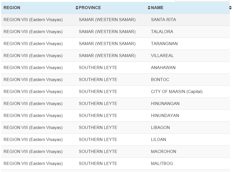
A total of 220 municipalities from Regions IV-A to XIII were listed by Project NOAH (Nationwide Operational Assessment of Hazards) as Typhoon ‘Ruby’ (international name ‘Hagupit’) makes its way towards land.
According to the Project NOAH website, “This list of flood susceptible areas is based on the forecasted accumulated rainfall which exceeds 100 mm in 24 hours during Typhoon Ruby. Updates to this list shall be made available as soon as a new severe weather forecast is made.”
Check out the list here: Project Noah flood-susceptible municipalities
Use the search bar to search for your town/area.
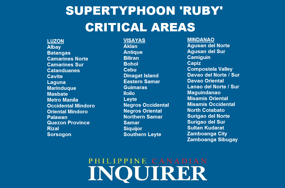
Meanwhile, DOST PAGASA listed the areas considered critical when ‘Ruby’ reaches land:

