Breaking
PAGASA sees no immediate weather disturbance as ‘Jose’ leaves PHL
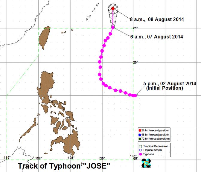
MANILA — Typhoon “Jose” has maintained its strength and is expected to exit the country Thursday morning, according to Philippine Atmospheric, Geophysical and Astronomical Services Administration (PAGASA).
PAGASA weather forecaster Chris Perez said typhoon Jose is expected to be outside the Philippine Area of Responsibility (PAR) on Thursday morning heading towards southern Japan.
Perez said the weather is expected to gradually improve in the next few hours until the weekend as no weather disturbance has been monitored near the PAR so far.
As of 5 a.m. the eye of typhoon Jose was located at 970 km northeast of Itbayat, Batanes packed with maximum sustained winds of 150 kph near the center and gustiness of up to 185 kph.
He added that it changed its movement from northward to north-northeast with its speed at 11 kph.
For Thursday forecast, PAGASA said southwest monsoon — the prevailing wind system during the rainy season — continues to affect Northern and Central Luzon.
PAGASA said Ilocos region and the Batanes and Calayan Group of Island will experience occasional rains while Metro Manila and the rest of the country will have partly cloudy to cloudy skies with isolated rainshowers or thunderstorms.
It added moderate to strong winds blowing from the southwest will prevail over Luzon and its coastal waters will be moderate to rough.
Elsewhere, winds will be light to moderate coming from the south to southwest with slight to moderate seas.
The state weather bureau said fisherfolk and those with small seacrafts are advised not to venture out over the seaboards of Northern and Central Luzon due to strong gale force wind associated with the surge of southwest monsoon which enhance by typhoon Jose.


