Headline
‘Ompong’ gains strength; TCWS 1 raised in several areas
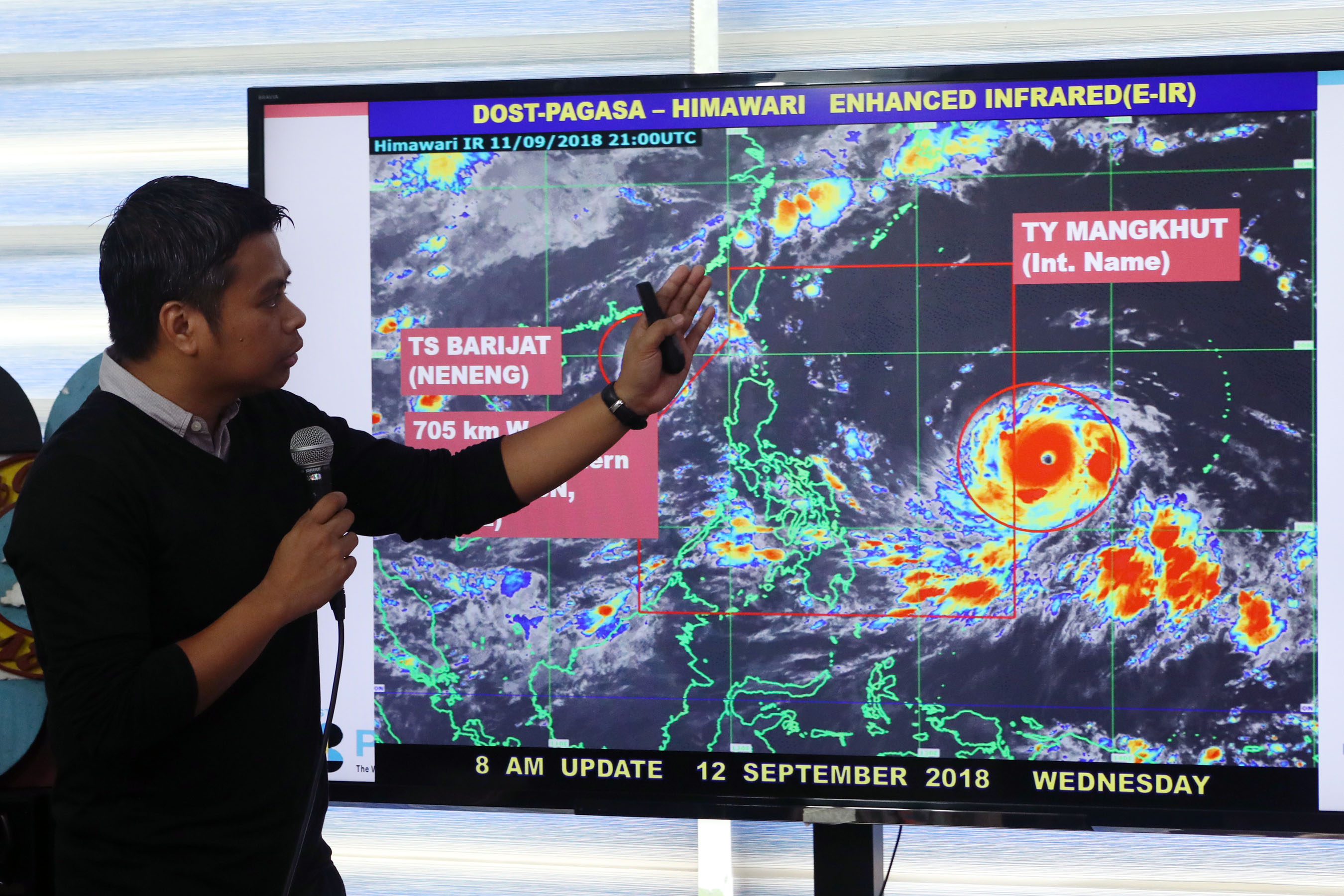
FILE: UPDATE ON ‘MANGKHUT’. Philippine Atmospheric, Geophysical and Astronomical Services Administration (PAGASA) Senior Weather Forecaster Christopher Perez gives an update on typhoon “Mangkhut”, which is expected to enhance monsoon rains until weekend during a press conference at the PAGASA headquarters in Diliman, Quezon City on Wednesday (Sept. 12, 2018). (PNA photo by Joey O. Razon)
MANILA — Several provinces on the eastern side of the country and northern Luzon have been placed under tropical cyclone warning signal number 1 as Typhoon “Ompong” (international name “Mangkhut”) gains strength.
In its 5 a.m. severe weather bulletin, the Philippine Atmospheric, Geophysical and Astronomical Services Administration (PAGASA) said TCWS 1 is hoisted over the provinces of Cagayan, Isabela, Kalinga, Mt. Province, Ifugao, Nueva Vizcaya, Quirino, Aurora, Quezon including Polilio Island, Camarines Norte, Camarines Sur, Albay, Sorsogon, Catanduanes, and Burias and Ticao Islands and Northern Samar.
Occasional rains with gusty winds will be felt in these areas.
At 4 a.m. Thursday, the eye of “Ompong” was last observed at 855 kilometers east of Virac, Catanduanes.
Its wind intensity is 205 kms per hour (kph) near the center and gustiness of up to 255 kph. It is moving inland at an accelerated pace of 30 kph.
It is expected to make landfall on the northern tip of Cagayan province on Saturday morning.
Northern Luzon is expected to get hit by heavy to intense rains, strong winds, rough seas and storm surges in coastal areas.
Strong to gale force winds due to “Ompong” is expected in Luzon’s northern and eastern seaboards and Visayas and Mindanao’s eastern seaboard. Fishermen are advised against going out into the sea.
“Ompong” has already torn through Guam and Marshall Islands in the Pacific, causing widespread flooding and power loss.