Philippine News
NAMRIA defends WPS label in official maps
Philippine Canadian Inquirer
February 19, 2026
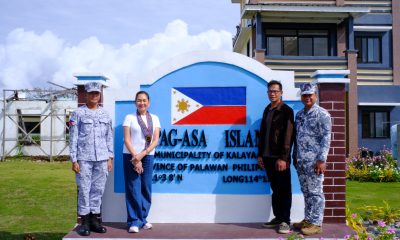
(Photo courtesy: National Mapping and Resource Information Authority)
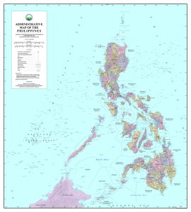
MANILA, Philippines — The National Mapping and Resource Information Authority (NAMRIA) on Wednesday spoke up amid ongoing discussions about the Philippine map, reminding the public and officials that the West Philippine Sea (WPS) has always been indicated in the country’s map for more than a decade.
“Since 2012, the Philippines has formally used the name West Philippine Sea in government publications,” NAMRIA stated, noting that the agency has consistently placed the label across its official maps and charts.
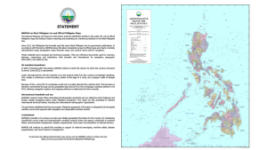
NAMRIA explained that under international law, the Exclusive Economic Zone (EEZ) extends up to 200 nautical miles from the country’s archipelagic baselines, creating a continuous curved boundary rather than a polygon with straight lines.
It added that enlisting a short list of coordinates would not accurately define the country’s maritime limit.
(Photo courtesy: National Mapping and Resource Information Authority)
“The boundary is therefore represented through precise geospatial data derived from the archipelagic baselines defined in RA 9522, allowing navigation systems and mapping software to determine the limit correctly,” NAMRIA emphasized.
The agency said its nautical charts follow international hydrographic standards and are submitted to relevant global technical bodies, including those of the International Hydrographic Organization.