Canada News
Oh, Canada: most major cities under winter weather warnings for cold, snow and storms
By Natalie Stechyson, CBC News, RCI
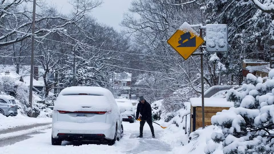
A person shovels the sidewalk after another winter snowfall in Toronto on Feb. 8, 2025. Environment Canada has issued winter weather warnings for most of southern Canada starting Wednesday. Photo: Showwei Chu/CBC
If you were looking for signs of an early spring, well, look elsewhere.
Most of southern Canada is about to get walloped by a strong hit of winter weather, almost as if to remind us there are still 36 days left in the season and we are to shovel, shiver and suffer through them.
As of Wednesday morning, swaths of every province and territory in the country except for the Northwest Territories were either under a weather warning, watch or statement, according to Environment Canada’s weather alert map. (new window) That’s 857 weather alerts total (but the day is young!).
The warnings were largely concentrated across the southern half of the provinces, painting the bottom half of the map red from just outside Lethbridge, Alta. — which can look forward to extreme cold with windchills down to –40 C — straight east to Fredericton, which can expect up to 25 centimetres of snowfall.
Weather alerts in Canada | See interactive map here (new window)
Sections of B.C. were also under warnings, with parts of the North Coast and Whistler due for Arctic outflow (strong winds combined with wind chill) Wednesday and Thursday, and Elk Valley, Yoho Park and Kootenay Park facing extreme cold, (new window) with wind chill values near –35 C.
On the other side of the country, Labrador City (new window), N.L., is under an extreme cold warning, with the wind chill dipping as low as –50 C overnight on Wednesday. Meanwhile, up north, Iqaluit has a blizzard warning, and so does Dempster, Yukon.
The entire southern half of Saskatchewan and Manitoba is due for extreme cold, with Regina, Saskatoon (new window) and Winnipeg all facing a multi-day episode
of wind chills of –40 C or lower.
As for southern Ontario and Quebec? The warnings are a real mixed bag of winter misery, including extreme cold, freezing rain, storms and snowfall, depending on where you live.
It’s going to be a messy drive,
the Ontario Provincial Police Highway Safety Division said in a video posted to X Tuesday night (new window).
Please take care. Stay in control. Slow down if you have to be out there. Avoid non-essential travel.
WATCH | Toronto expecting tons of snow:
Heavy snow in parts of Ontario, Pearson cancels some flights
Heavy snow is expected to hit much of southern Ontario (new window) starting Wednesday afternoon, including Toronto, which can expect about 15 centimetres, and Ottawa, which may get clobbered with up to 40 centimetres.
In the GTA, the following areas are currently under snowfall warning: Vaughan, Richmond Hill, Markham, Mississauga, Brampton, Uxbridge, Durham Region, Pickering, Oshawa, Newmarket, Georgina, York Region, Oakville, Halton Hills, Milton and Hamilton.
- Up to 40 cm of snow expected to blanket Ottawa-Gatineau (new window)
- Up to 40 cm of snow expected by tomorrow in southern Quebec (new window)
A winter storm warning is in effect for Barrie, Collingwood and Hillsdale for Wednesday evening into Thursday. Total snowfall amounts could reach up to 30 centimetres, Environment Canada said. At its peak, snowfall rates could exceed five centimetres an hour.
Several airlines have cancelled flights in anticipation of the storm, Toronto Pearson International Airport said in a post on X on Wednesday morning.
In Ottawa (new window), snowfall is expected to start Wednesday afternoon and affect the Thursday morning commute, according to Environment Canada, which also recommends avoiding travel if possible.
The agency issued a winter storm warning for Ottawa-Gatineau at 4:45 p.m. Tuesday, upgrading a winter storm watch issued earlier. A separate winter storm warning was issued Tuesday for western Quebec.
Environment Canada meteorologist Trudy Kidd said this will be the biggest winter storm to hit Ottawa since 2022, when 47.8 centimetres of snow fell.
Snow for Quebec, Maritimes
Nearly all of southern Quebec is under winter storm and snowfall warnings.
Montreal faces a winter storm warning, (new window) which is issued when several types of severe winter weather are forecast at once. The area could see as much as 40 centimetres of snow Wednesday through Thursday, plus moderate winds that will generate local blowing snow,
according to Environment Canada.
Environment and Climate Change Canada has issued a warning for the regions of Montreal, Montérégie, the Laurentians, Lanaudière, Outaouais and Mont-Laurier.
Quebec City faces a similar winter storm warning, with total snowfall accumulations of 15 to 30 centimetres expected beginning Thursday morning through Friday morning.
WATCH | How to feel more confident driving in snow:
Almost the entire province of New Brunswick (new window) is under a snowfall warning, including Fredericton, which could see snowfall up to 25 centimetres starting Thursday morning, which could then mix with ice pellets. The rest of New Brunswick, including Saint John and Moncton, is under a special weather statement for significant winter weather.
Environment Canada issued a special weather statement for most of Nova Scotia (new window), plus a winter storm watch for Inverness County, Richmond County, Sydney and Cape Breton County, and Victoria County. Halifax can expect messy winter weather
Thursday, with up to 10 centimetres of snow.
All of P.E.I. is under a special weather statement beginning Thursday, with up to 25 centimetres of snowfall predicted in some areas. Same for nearly all of Newfoundland, which is forecast to be hit with snow, winds and blowing snow Thursday into Friday.
With files from CBC Toronto, Ottawa, Montreal
This article is republished from RCI.