Philippine News
‘Ramil’ out of PAR Thursday evening or Friday morning: PAGASA

Sea travel remains risky over the northern and eastern seaboards of northern Luzon due to “Ramil” and the surge of the northeast monsoon. (Photo: Dost_pagasa/Facebook)
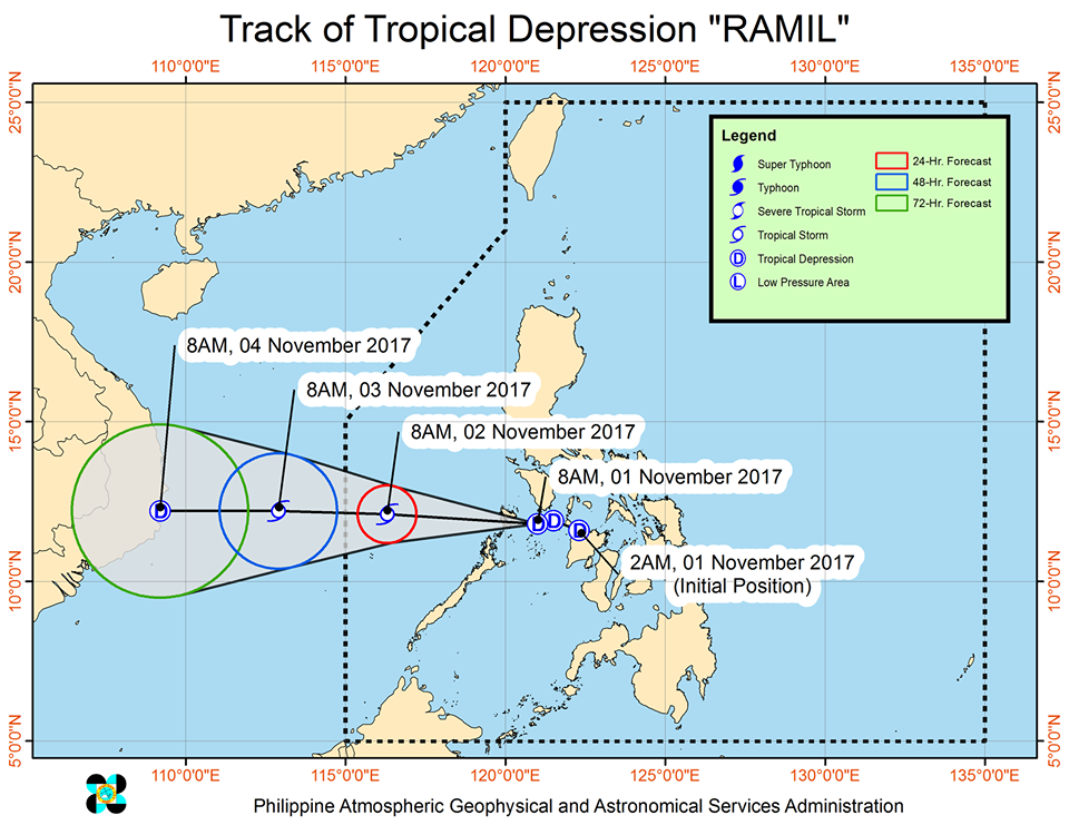
MANILA— State weather bureau Philippine Atmospheric, Geophysical and Astronomical Services Administration (PAGASA) said on Thursday that tropical depression “Ramil” has maintained its strength and now over the Philippine Sea.
It is expected to exit the Philippine Area of Responsibility (PAR) Thursday night or Friday morning.
According to PAGASA’s severe weather bulletin issued Thursday, “Ramil” was estimated at 210 kilometers west of Coron, Palawan province with maximum sustained winds at 55 km/h near center and gustiness up to 65 km/h. It is forecast to move west at 15 km/h,
Meanwhile, the northeast monsoon continues to affect northern Luzon. Moderate to occasional heavy rains are expected over the provinces of Mindoro, Palawan, Batangas, northern Quezon, including Polillo Island and Aurora. Residents in these areas are alerted against possible floods and landslides.
Meanwhile, light to moderate with possible occasional heavy rains will prevail over Metro Manila and the rest of Luzon.
Sea travel remains risky over the northern and eastern seaboards of northern Luzon due to “Ramil” and the surge of the northeast monsoon.


