Breaking
‘Ferdie’ nears super typhoon strength
MANILA – State forecasters are not discounting the possibility of typhoon ‘Ferdie’ (international name ‘Meranti’) further intensifying into a super typhoon while inside the Philippine Area of Responsibility (PAR).
Such scenario is possible since the already intense ‘Ferdie’ threatening Northern Luzon at present is still over water where this typhoon can further gather energy it needs to gain more strength, said Buddy Javier, who is a weather forecaster of State-run Philippine Atmospheric,Geophysical and Astronomical Services Administration (PAGASA).
“Communities there must prepare for such possibility,” he said.
He warned of more downpour, stronger winds, rougher seas and higher storm surges if ‘Ferdie’ intensifies further.
Javier urged precaution, noting PAGASA’s 9th severe weather bulletin issued Tuesday (Sept. 13) already raised tropical cyclone warning signal 4 in Northern Luzon’s Batanes province as the agency forecast there 171 kph to 220 kph winds from ‘Ferdie.
’
He said PAGASA expects ‘Ferdie’ to landfall in Batanes this Wednesday (Sept. 14) and exit PAR later that day.
“Coastal areas there can experience storm surges two to three meters high,” he noted.
Waves in waters off Batanes can rise beyond 14 meters, he also said.
“Heavy rainfall is likely there,” he said further.
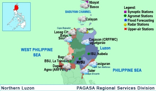
PAGASA also said signal 3 is already prevailing in Babuyan Islands where 121 kph to 170 kph winds, rough waters and up to 2.0 meter-high storm surges can be expected.
Signal 2 is over Ilocos Norte, northern Cagayan and Apayao province as PAGASA expects 61 kph to 120 kph winds there aside from 4.1 meter- to 14 meter-high waves and possible storm surges.
The rest of Cagayan, northern areas of both Isabela and Ilocos Sur provinces as well as Kalinga and Abra provinces are under signal 1 where 30 kph to 60 kph winds are likely, PAGASA noted.
PAGASA located ‘Ferdie’ at some 340 km east-southeast of Batanes’ Basco municipality as of 10 a.m. Tuesday.
‘Ferdie’ then packed maximum sustained winds of 215 kph near its center, said PAGASA.
“That strength is already very near the minimum super typhoon level of 220 kph and ‘Ferdie’ can still intensify further,” Javier said.
He also said ‘Ferdie’ registered gustiness of 250 kph.
The typhoon will likely move west-northwest at a faster 23 kph, he continued.
PAGASA data also show the diameter of ‘Ferdie’ is already enlarged to 600 km from 500 km earlier.
“That typhoon has a bigger circulation already,” Javier said.
PAGASA weather forecaster Aldczar Aurelio also urged preparations for looming onslaught of ‘Ferdie.’
“There’s possibility for ‘Ferdie’ intensifying further and moving faster,” he said.
He said Northern Luzon communities will experience impacts of ‘Ferdie’ beginning Tuesday night.
Aurelio noted that PAGASA is monitoring two tropical cyclones (TCs) outside PAR at present.
The TC southeast of Vietnam is moving west-northwest and unlikely to affect ‘Ferdie,’ he said.
Data indicate “low” chance for such TC to enter PAR, he noted.
“Still too far to affect ‘Ferdie’ is the TC west of Guam and moving westwards,” Aurelio said further.
He noted PAGASA expects such TC to enter PAR this Wednesday.
Javier said the TC is already a storm with maximum sustained winds of 65 kph and gustiness of up to 80 kph.
He noted PAGASA will name the storm ‘Gener’ once this TC enters PAR.


