Philippine News
PAGASA continues to monitor TS “Bavy”, expects to enter PAR on Tuesday
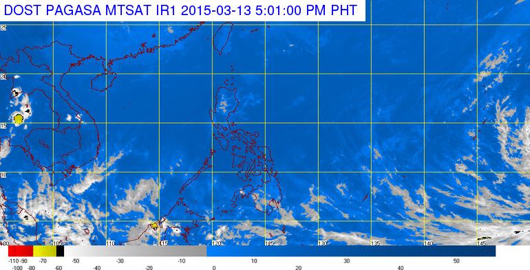
MANILA — The Philippine Atmospheric, Geophysical and Astronomical Services Administration (PAGASA) continues to monitor the tropical storm outside the Philippine Area of Responsiblity (PAR), which has a high chance to enter the country next week.
In an interview, PAGASA weather forecaster Jaime Bordales on Friday said the tropical storm with international name “Bavy” was located 4.000 km east of Mindanao packed with maximum sustained winds of 75 kph and gustiness up to 90 kph and moving northwest at 25 kph.
Bordales said so far the tropical storm is still far and will not affect the country until weekend.
However, he said the tropical storm is expected to enter PAR by Tuesday evening or Wednesday morning.
Once it entered the PAR, Bordales said it will be locally named “Betty” the first tropical cyclone to enter for this month and second for this year.
Until weekend, except for isolated light rains, most parts of the country will be generally fair weather, he said.
Expect light rains over parts of Northern and Central Luzon due to northeast monsoon which continues to affect these areas.
In its Friday forecast, PAGASA said Cagayan Valley, Cordillera Administrative Region (CAR) and the province of Aurora will experience cloudy skies with light rains while the rest of the country including Metro Manila will have partly cloudy to cloudy skies with isolated rainshowers or thunderstorms.
Temperature in Metro Manila on Friday will range 22-30 degrees Celsius.
Due to weakened northeast monsoon, the state weather bureau lifted the gale warning as the fisherfolks are safe to venture the seas.
In its advisory, PAGASA said light to moderate winds coming from the northeast will prevail throughout the whole archipelago with slight to moderate seas.


