Breaking
Typhoon ‘Ompong’ maintains strength and slows movement over PHL sea
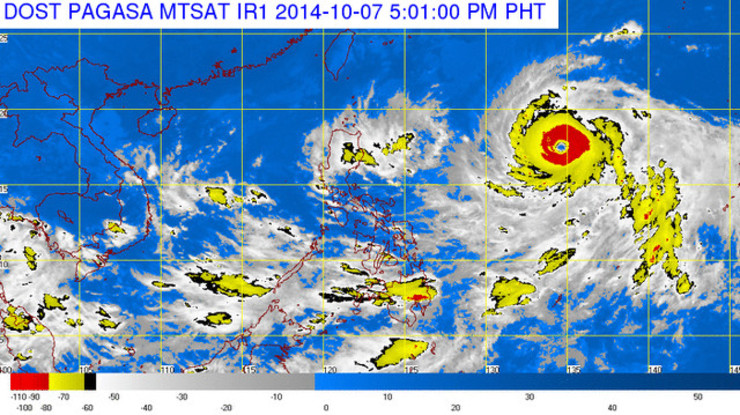
MANILA — Typhoon “Ompong” has maintained strength and decelerated speed as it continues to move west northwest over the Philippine Sea, the state weather bureau said on Wednesday.
In its 11:00 a.m. weather bulletin, PAGASA said that as of 10:00 a.m., the eye of typhoon “Ompong” was located at 1,080 km east of Tuguegarao City (18.0°N, 131.9°E) packed with maximum sustained winds of 215 kilometer per hour (kph) near the center and gustiness of up to 250 kph.
It continues to move west northwest but its speed decreased from 17 kph on Wednesday morning to 9 kph before noon.
Typhoon Ompong is forecast to be at 920 km east of Calayan, Cagayan by Thursday morning and at 870 km east of Basco, Batanes by Friday morning.
By Saturday morning, the typhoon is expected to be at 975 km northeast of Basco, Batanes.
Meanwhile, no Public Storm Warning Signal was raised and the typhoon is too far to affect any part of the country.
However, Ompong will enhance the northeasterly winds resulting to rough to very rough sea conditions over the seaboards of Northern Luzon and the eastern seaboard of Central and Southern Luzon.
Fisher folks and those using small sea crafts are advised not to venture out over the said seaboards,” PAGASA warned.
The estimated rainfall amount is from 7.5 – 25 mm per hour (heavy – intense) within the 700 km diameter of the typhoon.
PAGASA weather forecaster Gener Quitlong said the typhoon is expected to change its movement from westward to northward in the coming days due to the presence of ridge of high pressure area.
He added that “Ompong” will likely follow the track of typhoon “Neneng” as it heads toward southern Japan.
Quitlong said the typhoon is too far to affect the country and not expected to make landfall in any part of the country.


