Breaking
TD ‘Inday’ maintains strength, gains speed
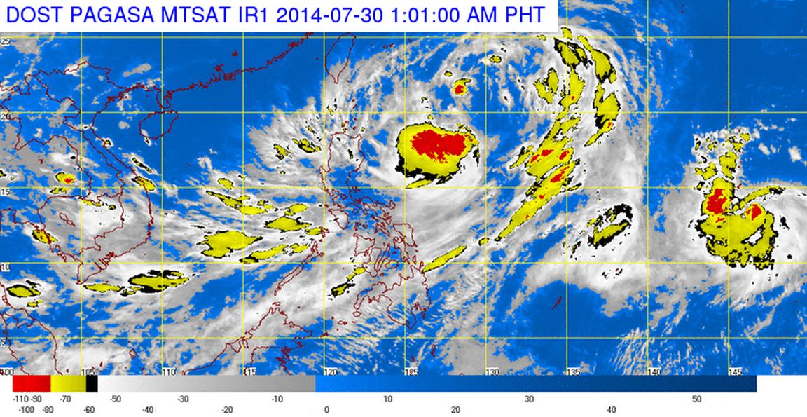
MANILA — Tropical depression “Inday” has maintained its strength and direction of movement but accelerated while still over the sea off Cagayan, according to the Philippine Atmospheric, Geophysical and Astronomical Services Administration (PAGASA) on Tuesday.
In an interview, PAGASA weather forecaster Samuel Duran said that as of 4 p.m., tropical depression “Inday” was located at 720 kilometers east of Aparri, Cagayan (18.
8°N, 129.4°E) packed with maximum sustained winds of 55 kilometers per hour near the center.
He added that Inday is forecast to move northwest and accelerate its speed from 15 kph to 20 kph.
If it maintains its speed and movement, Duran said Inday is expected to exit the Philippine Area of Responsibility (PAR) by Thursday afternoon and head toward southern Japan or northern Taiwan.
Duran also said that since Inday is still in the sea, it is expected to intensify into a tropical storm within the next 24 hours.
He added it is not expected to hit or cross the Philippine landmass but will continue to enhance the southwest monsoon or “hanging habagat” that will induce occasional rains over Metro Manila, Calabarzon (Cavite, Laguna, Batangas, Rizal and Quezon), Mimaropa (Mindoro, Marinduque, Romblon and Palawan), Bicol region, Western Visayas and the provinces of Zambales and Bataan.
The rest of the country will have partly cloudy to cloudy skies with isolated rainshowers or thunderstorms.
Duran said the state weather bureau also issued gale warning as strong to gale force winds associated with the southwest monsoon enhanced by Inday will affect the eastern seaboard of Central, Southern Luzon and the Visayas and the western seaboard of Southern Luzon.
“Fishing boats and other small sea crafts are advised not to venture out into the sea while larger sea vessels are alerted against big waves,” the agency said.


