Breaking
LPA to intensify into tropical cyclone in next 24 hours — PAGASA

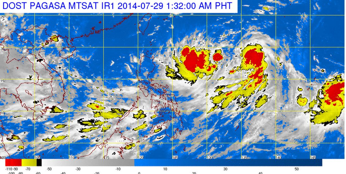
Satellite image courtesy of DOST PAGASA
MANILA –- The weather disturbance inside the Philippine area of responsibility (PAR) is expected to intensify into a tropical cyclone in the next 24 hours, the state weather bureau said on Monday.
PAGASA weather forecaster Alvin Pura said that as of 4:00 p.m. the low pressure area (LPA) is spotted some 1,080 km east of Northern Luzon (17.6ºN, 133.7ºE).
He added that once the LPA develops into a tropical depression inside the country, it will be locally named “Inday,” the ninth tropical cyclone to enter the country this year.
Pura said occasional rains will still prevail in most parts of the country including Metro Manila due to the southwest monsoon.
In its 5:00 p.m. advisory, PAGASA said Calabarzon (Cavite, Laguna, Batangas, Rizal and Quezon), Mimaropa (Mindoro, Marinduque, Romblon and Palawan), Bicol Region, Western Visayas, and the provinces of Zambales and Bataan will experience monsoon rains.
The rest of the country will have partly cloudy skies with isolated rain showers, it added.
The state weather bureau also issued gale warning as strong to gale force winds associated with the surge of southwest monsoon affecting the western seaboard of Luzon and eastern seaboard of Visayas and Mindanao
“Fishing boats and other small seacrafts are advised not to venture out into the sea while larger sea vessels are alerted against big waves,” it warned
PAGASA also said moderate to strong winds blowing from the southwest to west will prevail over Southern Luzon, Visayas and Mindanao and the coastal waters along these areas will be moderate to rough.
Elsewhere, winds will be light to moderate coming from the southwest to west with slight to moderate seas.


