Breaking
Typhoon ‘Henry’ slows down but maintains strength
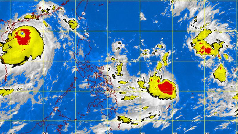
MANILA — Typhoon “Henry” has slowed down slightly but maintained its course and intensity while heading toward extreme Northern Luzon, the Philippine Atmospheric, Geophysical and Astronomical Services Administration (PAGASA) said Sunday.
In an interview, PAGASA weather forecaster Jun Galang said that as of 10 a.m., the eye of the typhoon was located at 420 kilometers east-northeast of Borongan, Eastern Samar (12.6°N, 129.5°E) packed with maximum sustained winds of 120 kilometers per hour near the center and gustiness of up to 150 kph.
Galang said “Henry” continues to move northwestward but decelerates its speed from 15 kph to 13 kph due to the ridge of high pressure area which prevents its fast movement.
He added that the typhoon is not expected to make landfall in any part of the country.
Residents in these areas are advised to be alert against possible flashfloods and landslides, PAGASA said.
The estimated rainfall amount is from 7.
5 to 15 millimeters per hour (moderate to heavy) within the 500-km diameter of the typhoon.
The agency added that fisherfolks and those with small sea crafts are advised not to venture out over the eastern seaboard of Bicol Region, the Visayas and Mindanao due to winds brought about by the typhoon.
With its present speed and movement, Galang said typhoon Henry is expected to be at 440 km northeast of Virac, Catanduanes by Monday morning, 360 km east-northeast of Aparri, Cagayan by Tuesday morning, and 210 km north- northwest of Basco, Batanes by Wednesday morning.
Galang also said the typhoon will enhance the southwest monsoon on Wednesday that will bring rains over most parts of the country, including Metro Manila.
He said that the typhoon is expected to be out of the country by Wednesday as it heads toward Taiwan.


